
Quebrada la Mina Riverbed Trail
- TICATOVE/ Angie

- Feb 17, 2021
- 1 min read
Updated: Feb 27, 2021

Quebrada la Mina Trail system has multiple trailheads. There is a future vision to connect the system as a loop, however it is currently an out and back. As you exit Esperanza, look for the dirt road entrance to Cayo de Tierra on the south side, turn south onto it. The trailhead is approx 0.2 miles in on the left side of the dirt road as you drive toward Cayo de Tierra.
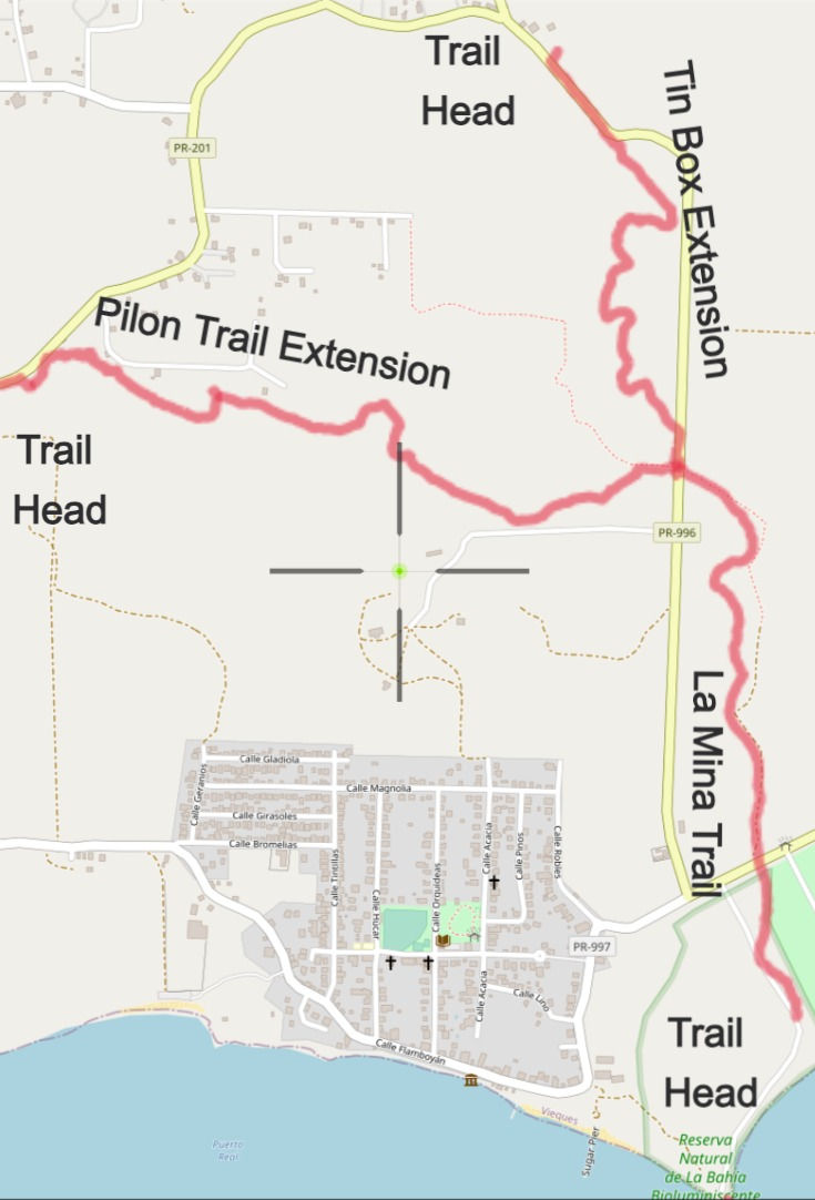

Southern Trailhead via the Cayo de Tierra dirt road, GPS: 18.0965, -65.4671

Plan 2 hrs, one way from the trailhead to the end of the Tin Box extension.

Recommend sneakers or shoes with good tread that can get wet.

Fairly flat trail over dirt, mud, grass, sand and rocks.


Distances:
From the Southern trailhead to the bridge on 996 where la Mina trail intersects with the Pilon extension and the Tin Box extension: 1.0 mile
GPS of the St. Rd. 996 underpass where the trails intersect: 18.1072, -65.4695
From the bridge to the culvert located at GPS: 18.1137, -65.4708: additional .9 mile
This culvert marks the end of the Tin Box extension to the la Mina trail. To continue to Tin Box, exit the trail at the large culvert and continue on St. Rd. 996 .2 mile to Tin Box (located at the intersection of St. Rd. 201 and St. Rd. 996).
Trail is located on land managed by the Puerto Rico Dept. of Nat. Resources
Post text, images and map by Greg Guckenburg
Distance Icon made by Pixel perfect from flaticon.com
Hourglass Icon made by Freepik from flaticon.com
Shoe Icon made by photo3idea_studio from flaticon.com
Effort Icon made by geotatah from flaticon.com


Comments